From the 9th of January
through the 30th of January, we took a long road trip to southern
while in the middle of winter.
This trip was wonderful and relaxing. We had perfect weather the
entire time.
We drove down US Hwy 197
and 97 to just south of Bend, Oregon, then took Oregon
Highway 31 southeast to
pick up US Hwy 395, which we then followed all the way to
within just a few miles of
La Quinta, where we rented an Air B&B, stopping for the
night at Alturas California
and Bishop California. We hiked Joshua Tree National Park,
We then crossed the coastal
mountains to the Pacific coast to Seal Beach,
where we stayed
for three more days. Then is was three days up
I-5 and US-97 back home, stopping at Lathrop,
California and Klamath
Falls, Oregon.

|

|

|

|
|
Eastern Oregon, 9-Jan
|
Eastern Oregon, 9-Jan
|
Eastern Oregon, 9-Jan
|
Eastern Oregon, 9-Jan
|

|

|

|

|
|
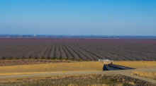
California high desert, west side of Honey Lake, 10-Jan
|
California high desert, 10-Jan
|
10-Jan-2025, California high desert
|
10-Jan-2025, California high desert
|

|

|

|

|
|
10-Jan-2025, California high desert
|
10-Jan-2025, California high desert
|
10-Jan-2025, California high desert, Honey Lake
|
Into Nevada briefly near Reno and Carson City, 10-Jan
|

|

|

|
|
|
Topaz Lake,
Nevada, 10-Jan
|
Approaching Conway
Summit, the highest road on our trip
|
10-Jan-2025, Mono Lake
|
|

|

|

|

|
|
10-Jan-2025, Mono Lake
|
10-Jan-2025, Mono Lake
|
10-Jan-2025, Me, near Bishop, California, probably taking the
photo shown, next right
|
10-Jan-2025, Moonrise over the White
Mountains, Owens
Valley
|

|

|

|

|
|
11-Jan-2025, Owens
Valley and the high Sierra
Nevada
|
11-Jan-2025, Owens
Valley and the high Sierra
Nevada
|
11-Jan-2025, Owens
Valley and the high Sierra
Nevada
|
11-Jan-2025, Owens
Valley and the high Sierra
Nevada
|

|

|

|

|
|
11-Jan-2025, Owens
Valley and the White
Mountains
|
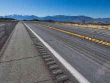
11-Jan-2025, Owens
Valley and US
Highway 395
|
11-Jan-2025, Owens
Valley and the high Sierra
Nevada
|
11-Jan-2025, Owens
Valley
|

|

|

|

|
|
11-Jan-2025, Owens
Valley and the high Sierra
Nevada
|
11-Jan-2025, Owens
Valley and the high Sierra
Nevada
|
11-Jan-2025, Owens
Valley and US
Highway 395
|
11-Jan-2025, Owens
Valley and the high Sierra
Nevada, Mount
Whitney
|

|

|

|

|
|
11-Jan-2025, Owens
Valley and the high Sierra
Nevada
|
11-Jan-2025, Owens
Valley and the high Sierra
Nevada, Mount
Whitney
|
11-Jan-2025, Owens
Valley and the high Sierra
Nevada, Mount
Whitney
|
11-Jan-2025, Owens
Valley and the high Sierra
Nevada, Mount
Whitney
|

|

|

|

|
|
11-Jan-2025, Owens
Valley
|
Getting closer, 11-Jan-25
|
Moonrise from the grocery store we shopped at (Vons)
|
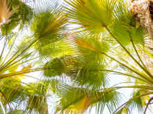
Palm trees
|

|

|


|

|
|
Palm trees
|
Our neighborhood in La
Quinta where we rented a house
|
Palm trees
|
Our neighborhood in La
Quinta where we rented a house
|

|

|

|

|
|
Lots of windmills near Palm Springs
|
Our neighborhood in La
Quinta where we rented a house
|
Our neighborhood in La
Quinta where we rented a house
|
Our neighborhood in La
Quinta where we rented a house
|

|

|

|

|
|
Our neighborhood in La
Quinta where we rented a house
|
Our neighborhood in La
Quinta where we rented a house, Bougainvillea
|
Andreas
Canyon
|
Andreas
Canyon
|

|

|

|

|
|
Andreas
Canyon
|
Andreas
Canyon
|
Andreas
Canyon
|
Andreas
Canyon
|

|

|


|

|
|
Andreas
Canyon
|
Andreas
Canyon
|
Andreas
Canyon
|
Andreas
Canyon
|

|

|

|

|
|
Andreas
Canyon
|
Andreas
Canyon
|
Andreas
Canyon
|
Andreas
Canyon
|

|


|

|

|
|
Andreas
Canyon
|
Andreas
Canyon
A Roadrunner
|
Andreas
Canyon
|
Old Town La
Quinta
|

|
|


|

|
|
Old Town La
Quinta
|
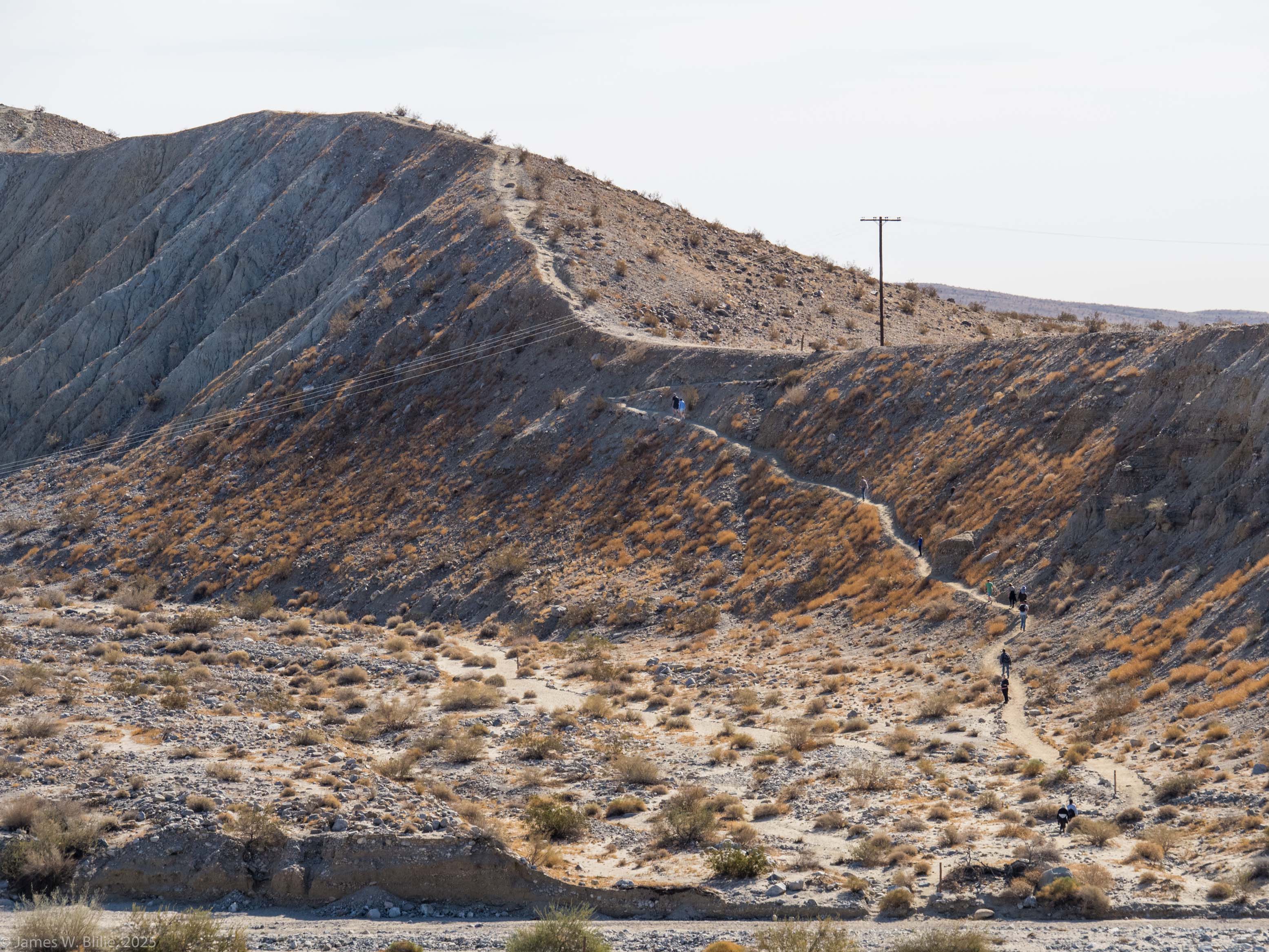
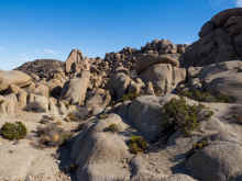
Joshua
Tree National Park
Split Rock hike
|
Joshua
Tree National Park
Split Rock hike
|
Joshua
Tree National Park
Split Rock hike
|

|

|

|

|
|
Joshua
Tree National Park
Split Rock hike
|
Joshua
Tree National Park
Split Rock hike
|
Joshua
Tree National Park
Split Rock hike
|
Joshua
Tree National Park
Split Rock hike, Teddybear
Cholla cactus
|

|

|

|

|
|
Joshua
Tree National Park
Split Rock hike
|
Joshua
Tree National Park
Split Rock hike
|
Joshua
Tree National Park
Split Rock hike
|
Joshua
Tree National Park
Split Rock hike
|

|


|

|

|
|
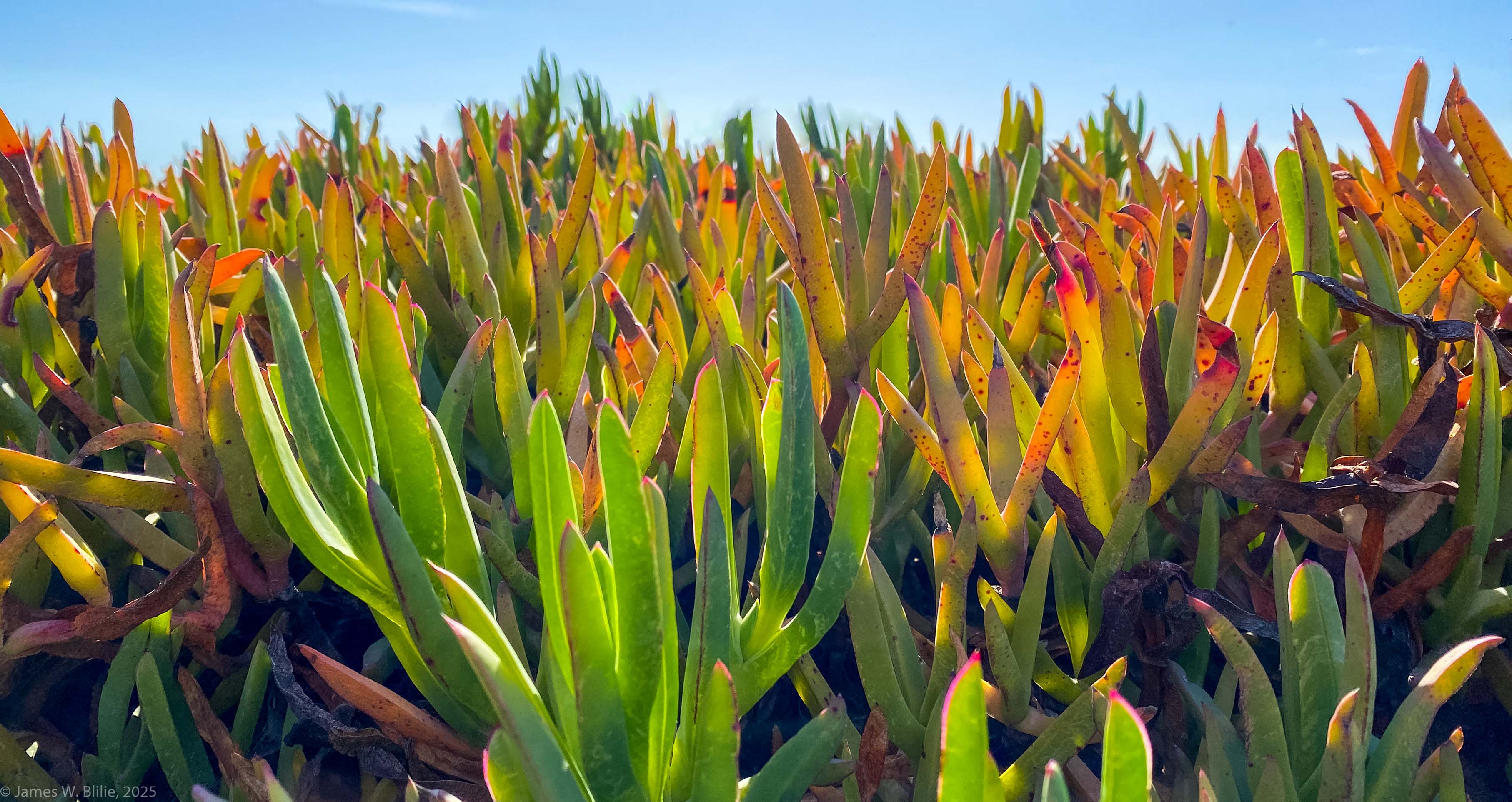
Willis Grove hike
Coachella
Valley Preserve
|
Willis Grove hike
Coachella
Valley Preserve
|
Willis Grove hike
Coachella
Valley Preserve
|
Willis Grove hike
Coachella
Valley Preserve
|
|

|

|

|

|
|
Willis Grove hike
Coachella
Valley Preserve
|
Willis Grove hike
Coachella
Valley Preserve
|
Willis Grove hike
Coachella
Valley Preserve, salt on the surface
|
Willis Grove hike
Coachella
Valley Preserve
|
|

|

|

|

|
|
Willis Grove hike
Coachella
Valley Preserve
|
Willis Grove hike
Coachella
Valley Preserve
|
Willis Grove hike
Coachella
Valley Preserve
|
Our back deck at
night
|

|

|

|

|
|
The house we rented in La Quinta
|
The house we rented in La Quinta
|
The house we rented in La Quinta
|
The house we rented in La Quinta
|
|

|

|

|

|
|
Palm
Springs Aerial Tramway
|
Palm
Springs Aerial Tramway
|
Palm
Springs Aerial Tramway
|
Palm
Springs Aerial Tramway
|
|

|

|

|

|
|
Palm
Springs Aerial Tramway
|
Palm
Springs Aerial Tramway
|
Palm
Springs Aerial Tramway
|
Mount
San Jacinto State Park
(at the top of the Tramway)
|
|

|

|

|

|
|
Mount
San Jacinto State Park
(at the top of the Tramway)
|
Mount
San Jacinto State Park
(at the top of the Tramway)
|
Mount
San Jacinto State Park
(at the top of the Tramway)
View over the Coachella
Valley
|
Palm
Springs Aerial Tramway
|
|

|
|

|

|
|
Palm Springs Aerial Tramway
|
Palm Springs Aerial Tramway
|
Palm Springs Aerial Tramway
|
Palm Springs Aerial Tramway
|

|

|


|

|
|
Palm Springs Aerial Tramway
|
Palm Springs Aerial Tramway
|
Thousand Palms Oasis
Coachella
Valley Preserve
|
Thousand Palms Oasis
Coachella
Valley Preserve
|

|

|

|

|
|
Thousand Palms Oasis
Coachella
Valley Preserve
|
Thousand Palms Oasis
Coachella
Valley Preserve
|
Thousand Palms Oasis
Coachella
Valley Preserve
|
Thousand Palms Oasis
Coachella
Valley Preserve
|
|

|

|

|

|
|
Thousand Palms Oasis
Coachella
Valley Preserve
|
Thousand Palms Oasis
Coachella
Valley Preserve
|
Thousand Palms Oasis
Coachella
Valley Preserve
|
Thousand Palms Oasis
Coachella
Valley Preserve
|
|

|
|

|
|
|
Thousand Palms Oasis
Coachella
Valley Preserve
|
Thousand Palms Oasis
Coachella
Valley Preserve
|
Thousand Palms Oasis
Coachella
Valley Preserve
|
Crossing the mountains
to the coast
|
|


|

|

|

|
|
Crossing the mountains
to the coast
|
Crossing the mountains
to the coast
|
Seal
Beach, California
|
Seal
Beach, California
|
|


|
|

|

|
|
Seal
Beach, California
|
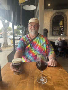
Seal
Beach, California,
at The
Abbey, drinking Chimay
|
Dinner (excellent) at
Finbar's Italian Grill, Seal
Beach, California
|
Dinner (excellent) at
Finbar's Italian Grill, Seal
Beach, California
|
|

|


|

|

|
|
Seal
Beach, California
|
Seal
Beach, California
|
Huntington
Beach, California
|
Huntington
Beach, California
|
|

|

|

|

|
|
Huntington
Beach, California
|
Huntington
Beach, California
|
Huntington
Beach, California
|
Homeward bound,
crossing LA on the 405, 28-Jan-2025
|
|

|

|

|

|
|
Homeward bound,
crossing LA on the 405, 28-Jan-2025
|
Homeward bound,
crossing LA on the 405, 28-Jan-2025
|
Homeward bound,
crossing LA on the 405, 28-Jan-2025
|
Climbing out of the
LA basin
|
|

|

|

|

|
|
Climbing out of the
LA basin
|
Into the Central
Valley for the next day of driving, 28-Jan-2025
|
Driving home:
The Central
Valley
|
Driving home:
The Central
Valley
|
|


|

|

|

|
|
Driving home:
The Central
Valley
|
Driving home:
The Central
Valley
Eucalyptus trees at a
rest area
|
Driving home:
The Central
Valley
Olive tree at a rest
area
|
Driving home:
The Central
Valley
Olive tree at a rest
area
|
|

|

|

|


|
|
Driving home:
The Central
Valley
Olive tree at a rest
area
|
Driving home:
The Central
Valley
Olive tree at a rest
area
|
Shasta
Lake, northern California
|
Castle
Crags, northern California
|
|

|


|

|

|
|
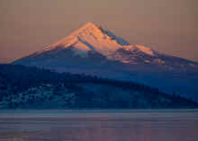
Driving home: Mount
Shasta from the south
|
Driving home: Mount
Shasta from the south
|
Driving home: Mount
Shasta from the west
|
Driving home: Black
Butte
|
|


|


|


|

|
|
Driving home: Mount
Shasta from near Weed,
California
|
Driving home: Mount
Shasta from near Weed,
California
|
Driving home: Mount
Shasta from near Weed,
California
|
Near Weed, California
|
|

|


|

|

|
|
Driving home: US
Highway 97 north of Weed,
California
|
Klamath Basin
|
Klamath Falls
|
Upper
Klamath Lake at dawn with Mount
Shasta visible
|
|
|

|

|


|
|
Upper
Klamath Lake at dawn with Mount
McLoughlin
|
Upper
Klamath Lake at dawn with Mount
McLoughlin
|
Climbing out of the
Klamath Basin
|
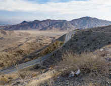
Oregon High Desert
It was COLD
|
|

|


|

|

|
|
Oregon High Desert
with Cascade volcanoes
|
Oregon High Desert
Smith
Rock State Park
|
Oregon High Desert
|
Approaching Criterion
Summit on US
Highway 197
|
|

|


|

|


|
|
Criterion
Summit on US
Highway 197 south of Maupin,
Oregon
|
Criterion
Summit on US
Highway 197 south of Maupin,
Oregon
|
Almost home, Mount
Hood on the horizon
|
Dropping into the Deschutes
River canyon at Maupin,
Oregon
|